


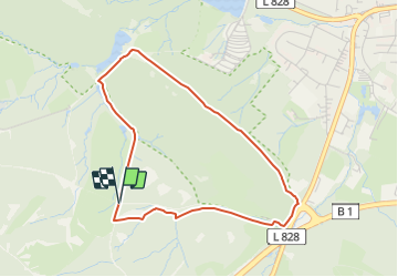

3.1 km | 4.3 km-effort
![Trail On foot Horn-Bad Meinberg - Rundwanderweg A5 [Horn] - Photo](https://media.geolcdn.com/t/1900/400/4fb4c3bc-36b1-4cb9-b69c-377d560ed1e3.jpeg&format=pjpeg&maxdim=2)

Tous les sentiers balisés d’Europe GUIDE+


FREE GPS app for hiking
 SityTrail
IGN / Geographical institutes
SityTrail World
The world is yours!
Trail On foot of 3.4 km to be discovered at North Rhine-Westphalia, Kreis Lippe, Horn-Bad Meinberg. This trail is proposed by SityTrail - itinéraires balisés pédestres.
Trail created by Lippischer Heimatbund.
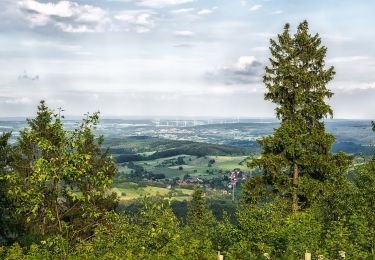
![Trail On foot Horn-Bad Meinberg - Rundwanderweg A5 [Horn] - Photo 1](https://media.geolcdn.com/t/2048/auto/f9e01780-2aee-4bfa-83a0-28cf9d0a9447.jpeg&format=jpg&maxdim=0 "Trail On foot Horn-Bad Meinberg - Rundwanderweg A5 [Horn] - Photo 1")
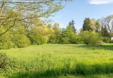
![Trail On foot Horn-Bad Meinberg - Rundwanderweg A5 [Horn] - Photo 2](https://media.geolcdn.com/t/2048/auto/977addba-a016-4048-a7e1-d9959a8bfbba.jpeg&format=jpg&maxdim=0 "Trail On foot Horn-Bad Meinberg - Rundwanderweg A5 [Horn] - Photo 2")
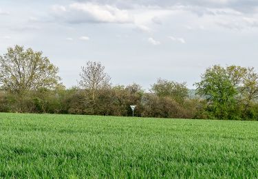
![Trail On foot Horn-Bad Meinberg - Rundwanderweg A5 [Horn] - Photo 3](https://media.geolcdn.com/t/2048/auto/0cd0e230-d118-4576-a79a-37e17281162f.jpeg&format=jpg&maxdim=0 "Trail On foot Horn-Bad Meinberg - Rundwanderweg A5 [Horn] - Photo 3")
![Trail On foot Horn-Bad Meinberg - Rundwanderweg A5 [Horn] - Photo 4](https://media.geolcdn.com/t/2048/auto/2a625dfa-c2e4-4bca-9509-08f1b558d0c4.jpeg&format=jpg&maxdim=0 "Trail On foot Horn-Bad Meinberg - Rundwanderweg A5 [Horn] - Photo 4")
![Trail On foot Horn-Bad Meinberg - Rundwanderweg A5 [Horn] - Photo 5](https://media.geolcdn.com/t/2048/auto/484ac64c-234f-4839-8831-3c494a90d5c8.jpeg&format=jpg&maxdim=0 "Trail On foot Horn-Bad Meinberg - Rundwanderweg A5 [Horn] - Photo 5")
![Trail On foot Horn-Bad Meinberg - Rundwanderweg A5 [Horn] - Photo 6](https://media.geolcdn.com/t/2048/auto/d1318fa2-6869-4ae2-882d-de0b0f406eb0.jpeg&format=jpg&maxdim=0 "Trail On foot Horn-Bad Meinberg - Rundwanderweg A5 [Horn] - Photo 6")
![Trail On foot Horn-Bad Meinberg - Rundwanderweg A5 [Horn] - Photo 7](https://media.geolcdn.com/t/2048/auto/eb39abe3-8f72-4f3e-a14d-34012a1dfe98.jpeg&format=jpg&maxdim=0 "Trail On foot Horn-Bad Meinberg - Rundwanderweg A5 [Horn] - Photo 7")
![Trail On foot Horn-Bad Meinberg - Rundwanderweg A5 [Horn] - Photo 8](https://media.geolcdn.com/t/2048/auto/909dbcd7-2e2e-46ac-a857-eacd19602d84.jpeg&format=jpg&maxdim=0 "Trail On foot Horn-Bad Meinberg - Rundwanderweg A5 [Horn] - Photo 8")
![Trail On foot Horn-Bad Meinberg - Rundwanderweg A5 [Horn] - Photo 9](https://media.geolcdn.com/t/2048/auto/a8ca74da-1187-49ac-b842-8c06f50db1d6.jpeg&format=jpg&maxdim=0 "Trail On foot Horn-Bad Meinberg - Rundwanderweg A5 [Horn] - Photo 9")
![Trail On foot Horn-Bad Meinberg - Rundwanderweg A5 [Horn] - Photo 10](https://media.geolcdn.com/t/2048/auto/4fb4c3bc-36b1-4cb9-b69c-377d560ed1e3.jpeg&format=jpg&maxdim=0 "Trail On foot Horn-Bad Meinberg - Rundwanderweg A5 [Horn] - Photo 10")
On foot
On foot
On foot
![Trail On foot Horn-Bad Meinberg - Rundwanderweg A4 [Feldrom] - Photo](https://media.geolcdn.com/t/375/260/c3e2fda2-4a4b-4515-b251-ad31aeb36002.jpeg&format=jpg&maxdim=2)
On foot
On foot
![Trail On foot Detmold - Rundwanderweg A5 [Berlebeck] - Photo](https://media.geolcdn.com/t/375/260/09e96dc8-2a72-420e-af43-8a0b6d458613.jpeg&format=jpg&maxdim=2)
On foot
On foot
On foot
On foot